
Following a Plainfield Township Street Directory
An address-led search in Plainfield Township should move from the address to a parcel, then from the parcel to the record system best suited to the question. Kent County's property search and GIS viewer can establish the map and assessment layer. The deed index supplies recorded parties and instruments. Election records and old directories are separate, dated sources, not extensions of the parcel record. This sequence keeps a street result useful without claiming that every named party lives there now.
Begin by preserving the exact address as supplied. Then note the postal city, ZIP, political jurisdiction, school district when shown, and the time period. The same township can use multiple postal localities. A parcel number is usually the most durable pivot when a street form changes or a name appears in more than one place.
- Use the county street directory or USPS to standardize the street, postal city, and ZIP.
- Search the address in Kent County Property Search and retain the full parcel identifier.
- Open the parcel in the Kent County Public Viewer for map context and adjacent parcel shapes.
- Use the Kent County deed index to locate recorded instruments and parties tied to the parcel.
- For a dated household lead, consult the library's directory collections, then confirm it with a source created for that period.
Plainfield Township Street Directory Normalization
Address normalization prevents a good parcel from disappearing behind a slightly different string. Kent Property Search advises users to avoid punctuation, try a direction prefix and then retry without it, omit street descriptors, omit direction suffixes, and test numeric and alphabetic forms for numbered streets. USPS ZIP Lookup has address, city-and-state, and cities-by-ZIP modes. USPS also cautions that an address result does not confirm that a person or organization is at that address.
Keep the original string and the normalized string together. If a range is searched, preserve the from and to values and odd or even choice. Preserve apartment or suite information separately from the base street. A current postal match helps validate delivery formatting. It does not establish occupancy, ownership, or historical continuity.
Plainfield Township Property Search Fields
Kent County Property Search is the current address and parcel gateway for an address research task. The interface allows a street number or range, street name, and city, township, or village selection. Select 26 - Plainfield Township in the municipality list. Active parcels are checked by default, inactive parcels are also available, and a CAPTCHA is required. The reviewed portal does not expose a direct owner-name field. When an address is unknown, use a parcel, GIS, assessor, or recorded-document route instead.
| Field | Available form option | Street-search use |
|---|---|---|
| Street number | Single number or range | Start with the known number or scan a road segment. |
| Street name | Name with alternate-format tips | Retry directions, suffixes, and numeric forms. |
| Municipality | City/Township/Village dropdown | Select Plainfield Township, not a mailing city alone. |
| Status | Active or inactive parcel | Record which setting produced the result. |
| Parcel number | 41 prefix with segmented fields | Keep all shown digits for later map and deed work. |
The Kent County Property Search page displays the official address and parcel forms used for a Plainfield Township address inquiry.
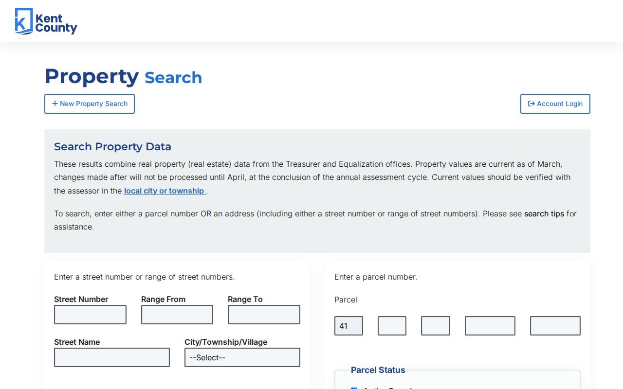
The portal combines Treasurer and Equalization information and says its information should be checked with the local assessor, particularly when a taxpayer or mailing field is important to the question.
Plainfield Township Street Directory Map Context
The Kent County Public Viewer adds geography to an address result. Its Parcel Owner Info layer includes fields for owner names, care-of lines, owner and taxpayer mailing information, property address, parcel number, document-link ID, source and edit fields, common-element status, and geometry. The viewer has an address-search box and a county accuracy and liability disclaimer. GIS geometry is useful map context, but it is not a deed, survey, or legal-boundary opinion. For tax-map or legal-description questions, Kent County Property Description and Mapping maintains maps and ownership descriptions and can provide map copies for a fee.
Map a road and its parcels before assuming a social relationship between addresses. Adjacent parcels can show the shape of a block and reveal which properties share a boundary. They do not confirm a household or current resident list. Follow a map click back to the source and date shown, then use the assessor or Register of Deeds for the relevant underlying record.
- Parcel
- A numbered property unit used by county assessment and mapping systems.
- Situs address
- The property-location address, which may differ from a mailing address.
- Plat
- A recorded map that depicts a subdivision or land division.
- Criss-cross directory
- A reverse directory arranged by address rather than only by name.
Plainfield Township Streets Have Four Postal Forms
The Kent County Street Directory shows why a street directory search must separate postal geography from jurisdiction. Plainfield Township examples appear under Belmont 49306, Comstock Park 49321, Rockford 49341, and Grand Rapids 49525. The same source contains address range, odd or even side, street, political jurisdiction, and school-district columns. A Grand Rapids postal line is not proof that the property lies in the City of Grand Rapids, and a ZIP does not describe the complete legal township boundary.
Read the range and school-district fields with the locality. Boyd Avenue and Boyd Court appear in Grand Rapids 49525 and Northview examples. Black Forest Drive appears in Rockford 49341. Gold Dust Street and Goldfinch Drive appear in Belmont 49306. Some 9 Mile Road examples use Comstock Park 49321 and different school-district labels by range. The county PDF is a street-range directory, not a list of every address or a ZIP-boundary map.
Plainfield Township Street Directory Records Matrix
Address-keyed systems can be chained, but the result should keep each system's purpose intact. Property Search and GIS help identify a parcel and map location. The deed index identifies recorded instruments. The election system concerns registration and election geography. Planning and permit files describe a separate administrative process. For any record outside the available portal window, the counter, written request, clerk, library, or archive may be the actual access route.
| Address-keyed source | What it can show | Custodian | Access channels |
|---|---|---|---|
| Property Search | Parcel and current assessment or tax context | Kent County and local assessor | Online address or parcel form; assessor question |
| GIS parcel layer | Property address, map geometry, owner or taxpayer field structure | Kent County GIS | Public Viewer and parcel-layer schema |
| Recorded instruments | Deeds, mortgages, liens, land contracts, releases | Register of Deeds | Free online index; image, visit, or written-copy request |
| Election records | Individual registration route and precinct context | Plainfield clerk and Michigan | MVIC; clerk or Bureau of Elections request |
| Permit and planning records | Documented building or land-use process | Plainfield Community Development | Cascade system, Township Hall drop-off or mail, department contact |
A street name links the sources, while the parcel number is the more stable bridge between assessment, map, and recorded-instrument research. Label a source as taxpayer, deed party, or historical directory line instead of treating all three as the same claim.
Plainfield Township Deed Index Finds Instruments
Kent County's deed index is the recorded-document layer for a street directory trail. The Register of Deeds says its online index goes back to January 1, 1970. Searches are free. Under the county's June 22, 2026 notice, basic printed or downloaded images cost $1 per page, while advanced access has a $25 24-hour option and a $2,000 annual option, plus a small convenience or handling fee. Fees and portal terms can change, so verify the current county notice before purchase.
The index functions as a guide, not the underlying document. Search spelling variants and both parties where the portal permits. Then capture the grantor, grantee, instrument type, recording date, instrument number or book and page, and legal description when available. A mortgage, lien, release, or land contract is not a deed conveyance. Older material may require a visit or a written request to the office with recording information.
The Kent County deed self-service portal is the official online index route.
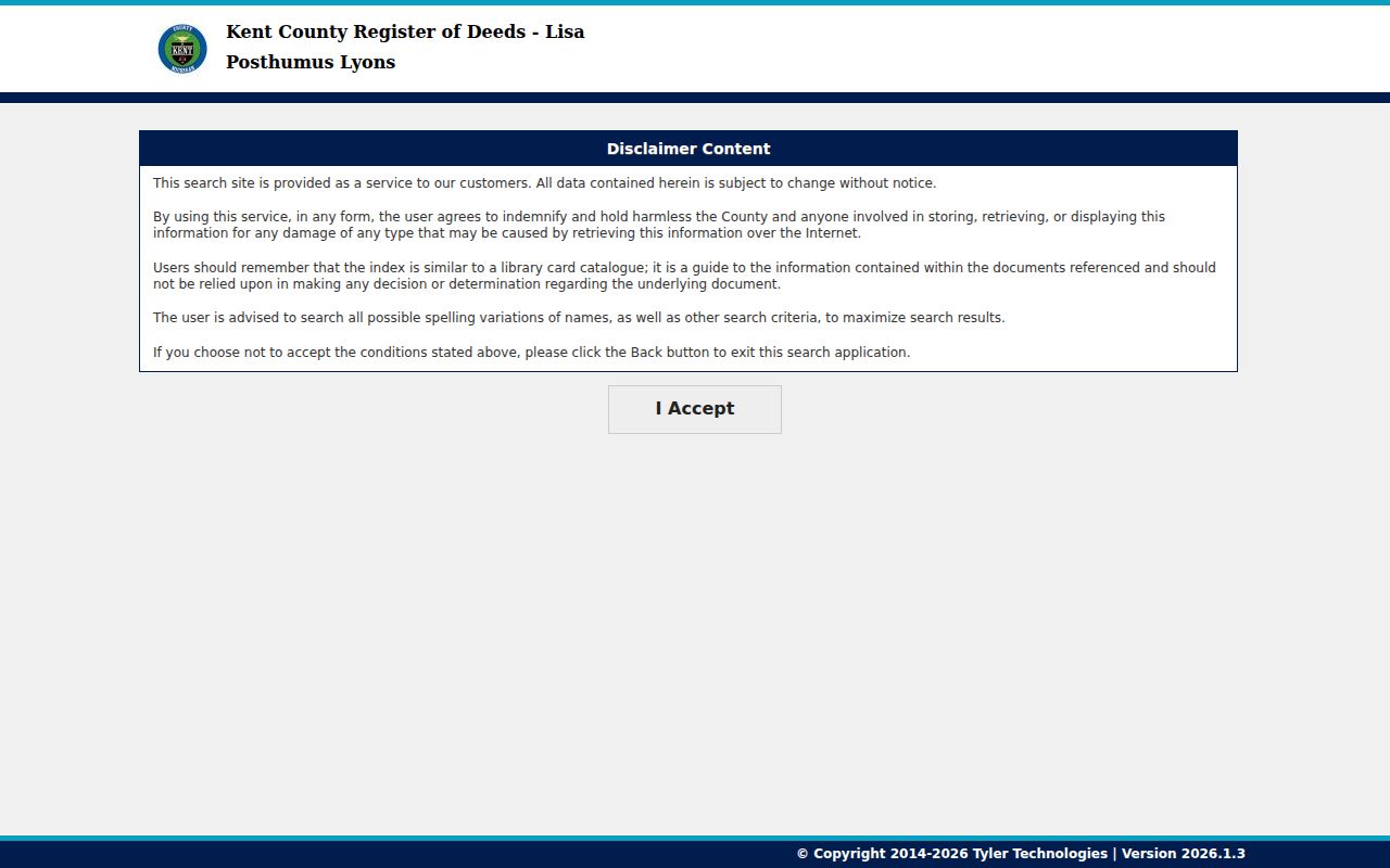
A document image supplies the recorded text, but the Register of Deeds does not provide legal advice or a title conclusion.
Plainfield Township Address Files Beyond Parcels
Plainfield Township Community Development is another address-based record path. The department covers Building Services, Planning and Zoning, Code Enforcement, Community Policing, ordinances, and floodplain mitigation. Building permits and inspections are handled through Cascade Township under Plainfield's arrangement. Materials can be submitted through Cascade's online system or dropped off or mailed to Township Hall. Planning and Zoning handles applications, plan reviews, policies, and ordinances.
These files can explain a documented building or land-use process. They should not be used to infer who lives at an address. When a permit, planning file, or code record is needed, state the address, date range, and record type to Community Development rather than making a broad request. The department's research contact number is 616-364-1190.
Plainfield Township Street History Needs Proof
No official source reviewed supplied a Plainfield-specific historical street-renumbering table. Grand Rapids Public Library's warning about a 1912 address change applies to many Grand Rapids addresses and should not be extended to the township. When an old directory line differs from a current address, compare the legal description, section or parcel, nearby roads, plat, deed, postal locality, and family name. Mark the bridge as tentative until two different source types agree.
GRPL's House History route supplies city directories, real-estate listing cards, plats, Sanborn maps, aerials, and other research leads. Its listed Kent plat material includes 1855-2007 physical items and 1855-1921 digital items. Confirm that a Grand Rapids-specific series actually covers a Plainfield Township address. Historical city-directory collections are treated in depth in the Plainfield Township Directory Book.
Plainfield Township Voter Geography by Street
Plainfield Township's clerk oversees ten precincts, and the election page directs individuals to the Michigan Voter Information Center for registration confirmation and polling-place lookup. MVIC answers an individual current-election question. It is not a street roster. For a public voter-record request, use the local clerk or Michigan Bureau of Elections and specify the jurisdiction, precinct, election cycle, public fields sought, and desired format.
Michigan makes voter-registration records public but withholds driver's-license and state-ID number, birth month and day, phone, email, source office, and refusal-to-register information. Postal locality can differ from township and precinct. Preserve the election year and precinct with a street result because boundaries and polling places can change. The reviewed sources did not establish a current Plainfield bulk-file fee or field layout.
Plainfield Township Street Directory Limits
A Plainfield Township street directory can help connect an address to a parcel, map, instrument, historical directory line, or precinct context. It cannot establish every person who has lived at an address. Postal matching does not verify occupancy. A taxpayer field is not automatically a deeded owner. GIS is not a survey. A voter result and a dated directory line have their own time limits. Utility and driver data have legal access limits that should not be bypassed.
Michigan's Address Confidentiality Program provides a designated address and mail forwarding for eligible participants. Do not try to reverse a protected physical address. Use the official assessor, clerk, map, Register of Deeds, library, archive, or court channel for a defined question, and record an access limitation when the source does not support the requested conclusion.