
Plainfield Township Neighbors Block Sources
Different sources answer different block questions in Plainfield Township. A parcel map can show the lots around an address. The property system can identify a parcel and distinguish a displayed owner or taxpayer field. The county street directory connects ranges to a political jurisdiction and school district. Election sources describe civic geography, but public voter data has withheld fields. Association pages can supply a neighborhood label, not a complete roster. Use the record's own scope before deciding what it shows about your neighbors.
| Source | What It Shows About a Block | Access |
|---|---|---|
| Kent County Public Viewer | Parcel geometry, nearby shapes, map context, and address search | Public viewer with accuracy and completeness disclaimer |
| Kent Property Search | Current address or parcel result and owner or taxpayer labels | Address or parcel fields, active/inactive choices, CAPTCHA |
| Kent County Street Directory | Street range, postal locality, jurisdiction, and school district | Official PDF crosswalk |
| Michigan Voter Information Center | Individual registration and polling-place questions | Official lookup with protected public fields |
| Association and civic pages | Community labels or organization self-descriptions | Lead only; no township-wide association registry was located |
A property owner is not automatically the present occupant. A taxpayer field can be different from an owner field. A parcel is geography, not a confirmed household list. Keep an address, parcel identifier, source date, and the relationship actually shown by the record rather than turning every nearby lot into a personal claim.
Map a Plainfield Township Neighbor Block
The adjacent-parcel method begins with one verified address in the Kent County Public Viewer. The viewer supplies map context, while the supporting parcel-owner layer can include owner names, taxpayer names, care-of and mailing fields, property address, parcel number, document-link ID, source and edit fields, common-element flag, and geometry. Those fields belong to the parcel record and should retain their labels.
- Locate the base address in the GIS viewer and save its parcel identifier, displayed property address, and access date.
- Zoom only to the immediately surrounding parcel shapes. Record adjacent parcel identifiers, not a speculative household list.
- Check a nearby parcel in Property Search and preserve whether the displayed relationship is owner, taxpayer, care-of, or mailing address.
- Use the county street row to retain postal locality, political jurisdiction, ZIP, and school district for the same range.
- For a whole named road rather than an immediate block, use the Plainfield Township street directory for the fuller street-level records path.
GIS geometry is a map representation, not a deed, survey, or legal boundary opinion. A common-element parcel, multiple owner names, or a care-of line can make a map click especially easy to misread.
Plainfield Township Neighbor Parcel Fields
Kent's GIS Parcel Owner Info layer is more detailed than a visual map alone. Its queryable fields include owner name 1 and 2, owner care-of, owner address and city/state/ZIP, taxpayer name and care-of, property address, parcel number, source, edit fields, common-element flag, and geometry. A source or edit date tells when that layer was maintained, not necessarily when a person moved or when a deed changed hands.
Use the Property Search as the address-to-parcel gateway. It accepts a street number or range, street name, and municipality. The municipality menu includes 26 - PLAINFIELD TOWNSHIP. It does not expose a direct owner-name search in the inspected interface, so an address or parcel is the right starting point. The result should be recorded with the current assessment year because the portal states that values are current as of March and later changes appear in the annual cycle.
Note: A parcel identifier is the most stable pivot when postal labels or street strings vary, but it still must be paired with the source's date and field labels.
Plainfield Township Neighbor Civic Labels
A block in Plainfield Township can carry several accurate labels at once. County street-directory rows use Belmont 49306, Comstock Park 49321, Rockford 49341, and Grand Rapids 49525 as postal localities. The same rows can name Northview Public Schools or Rockford Public Schools. The township election source identifies ten precincts. Nearby roads, trails, rivers, and other natural features add still more map context.
Keep the parcel, township, postal locality, ZIP, school district, precinct, and nearby road or water feature in separate fields. This prevents a false correction such as treating a Grand Rapids mailing address as a City of Grand Rapids address. It also avoids assuming that a school or postal boundary follows the same line as a parcel boundary. Compare the source dates when labels conflict because precinct and school boundaries can change.
Plainfield's 2024 Master Plan identifies the Grand River, Rogue River, lakes, streams, riparian areas, trails, transportation, and public places as part of the township context. Those features help explain the shape of a block without becoming a claim about an individual.
Plainfield Township Neighbor Association Leads
No official township-wide public association directory was located. The organizations below are research leads with self-described scope, not proof that every address in a named area belongs to an active group. Start with the exact subdivision or neighborhood name from a plat, parcel, zoning map, public-hearing document, or association page. Then test that name against county mapping and township material.
Evergreen Meadows HOA
Describes a 90-home Plainfield Township neighborhood near Rockford. The research did not capture a public contact URL or a full member roster.
Springbank of Plainfield
Describes a homeowners association with safety, welfare, and maintenance purposes. Its description is not a parcel-by-parcel membership determination.
Northeast Business Association
Describes a Northview community and business network formed in the early 1980s by local business owners, Northview Public Schools, and Plainfield Charter Township.
Citizens for Plainfield Township Trails
Describes a grassroots trail group formed after the 2015 parks survey and the 2016 trails millage. It is a civic-context lead, not a resident registry.
The capture from the Northeast Business Association is the available community-directory image. It illustrates a broader Northview connection, while also showing why one organization should not be treated as a complete association registry.
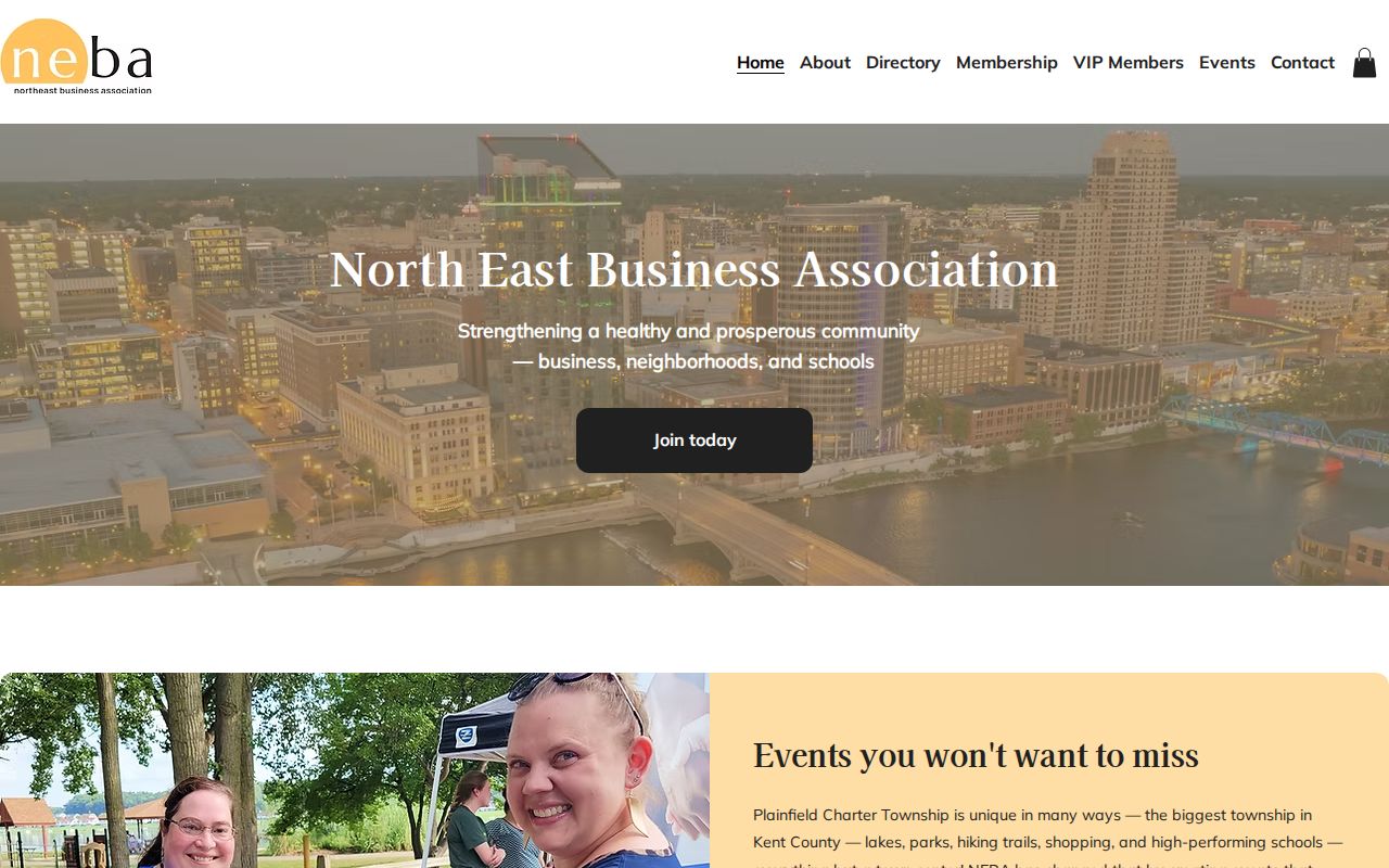
Association pages are useful names to compare with plats and public material. They do not confirm that an unlisted parcel has a current association connection.
Plainfield Township Neighbor Source Categories
Official records and commercial neighbor-lookup categories do different jobs. A category comparison makes the limits visible without treating a convenience result as a government record. Begin with the official source that was created for the question, then preserve the access date and scope.
| Source category | Useful block context | What it cannot establish alone |
|---|---|---|
| Official parcel and deed records | Parcel, title or taxpayer fields, address, and recorded transaction context | Every current occupant or household relationship |
| Official mapping and street-range records | Parcel shape, range, jurisdiction, postal locality, and school geography | A deed, survey, or confirmed social-neighbor list |
| Official election and civic sources | Precinct, polling-place, and public-record request paths | Protected voter fields or a complete neighborhood profile |
| Commercial neighbor-lookup category | A discovery prompt that requires independent checking | Authority to override a custodian record or privacy protection |
The county map has a disclaimer about accuracy and completeness. The Register of Deeds says its index is a guide and the underlying document controls. Keep those limits with the result instead of flattening each source into a single answer.
Plainfield Township Neighbor Privacy Limits
Michigan public access has firm boundaries. Voter records may be public, but driver's-license and state-ID numbers, birth month and day, phone, email, registration source office, and refusal-to-register information are withheld. Michigan does not register voters by party. Do not use an individual lookup to reconstruct those protected details. A public source should answer the narrow question for which it was created.
Michigan's Address Confidentiality Program is a stronger stop sign for address research. It can provide a designated address and free mail forwarding to eligible people at risk. The application includes the actual physical address, which must never be reverse-engineered or republished. If a block question touches a protected address, use the program's official guidance and stop the search rather than seeking more detail.
Lawful use. Plainfield Township neighbors research is for getting to know the block, personal safety awareness, civic questions, and source verification. Never use it to watch, stalk, harass, intimidate, or harm anyone.
Plainfield Township Neighbor Planning Context
For a place question rather than a person question, township planning records are often more useful than a name search. The Plainfield Master Plan supplies land-use, natural-feature, trail, transportation, and public-place context. The township's community-development material publishes public-hearing items and meeting locations. A planned road connection, trail, or public work can explain a block's changing context without making assumptions about a particular household.
Use a block record that preserves the base address, parcel, postal city, ZIP, school district, precinct, nearby feature, source URL, and access date. The result remains useful when a postal string changes or when new planning material appears. For an official public-record question, contact the appropriate township clerk or county custodian with the parcel and date range, not a broad request for every person connected to the block.
Plainfield was established in 1838 and became a charter township in 1978 by board resolution, according to the township's historical planning material. That history helps explain why a township record, a postal city, and a regional service label can coexist. It does not change the need to test every current block record against its source date and jurisdiction.